ABS Consulting Group, Inc.: Home | Blog | Resume | Speaking | Publications
Showing posts with label qgis. Show all posts

Thursday, September 24, 2020

GIS Ed Weekly: How many GIS software packages does a professional use?

Resources for Teaching and Learning

Visual Capitalist: 3D Map: The U.S. Cities With the Highest Economic Output - The map is from HowMuch.net and ranks the top 10 metro area economies in the country in 2018.

YouTube: Magical Van Gogh Exhibit - "Vincent Van Gogh’s paintings come to life at this magical exhibit located at Atelier des Lumières, Paris, France. Song 'Vincent' covered by Jim van der Zee." Via Ilkka Suvanto.

Thursday, September 19, 2019

GIS Education Weekly: Using StoryMaps to Teach about UASs

Resources for Teaching and Learning

Pilot Online: Online map details history of the state’s former Rosenwald schools for African Americans - "...Preservation Virginia recently completed an online, interactive map of the state’s Rosenwald Schools — 382 of the more than 5,300 built in the South from 1917 to 1932." I noted a grant to the National Trust for Historic Preservation to map the schools back in 2017.

The Guardian: Denmark frees 32 inmates over flaws in phone geolocation evidence - "Denmark has released 32 prisoners as part of an ongoing review of 10,700 criminal cases after serious questions arose about the reliability of geolocation data obtained from mobile phone operators, local media have reported." Via Thierry Gregorius.

Thursday, June 13, 2019

GIS Education Weekly: Fourth Graders Learn Precision Ag

Resources for Teaching and Learning

Education Week: Map: How Much Money Each State Spends Per Student - The average is about $13,000.
Spending Per Student

EFF: Stupid Patent of the Month - On April 12, the last day Apple had a store open in Eastern District of Texas the company "was sued by LBS Innovations, LLC, a patent-licensing company owned by two New York patent lawyers, Daniel Mitry and Timothy Salmon. Since it was formed in 2011, LBS has sued more than 60 companies, all in the Eastern District of Texas. Those defendants include some companies that make their own technology, like Yahoo, Waze, and Microsoft, but they’re mostly retailers that use software made by others. LBS has sued tire stores, pizza shops, pet-food stores, and many others, all for using internet-based maps and 'store location' features. LBS has sued retailers that use software made by Microsoft, others that use Mapquest, some that use Google, as well as those that use the open-source provider OpenStreetMaps." I used to cover such suits in my past life writing about the GIS industry; sadly, they are still around.

Thursday, March 28, 2019

GIS Education Weekly: New Online QGIS Course, New Coursera GIS MOOC

Resources

National Academy Press: Fostering Transformative Research in the Geographical Sciences via Tom Baker.

Census: Population Bracketology - "Test your knowledge of population data! Start by choosing your geographic level: metro areas or states. Click on the name in each match-up that you think has the larger population. Green shows a correct answer, red indicates an incorrect answer. When you have opposing names picked for the next round, pick again. See how close you can come to a perfect score of 63. When you are finished, play again or mouse-over results to view the most current population estimates for each pair." Via GIS User.

Thursday, March 21, 2019

GIS Education Weekly: NC State Launches Geo-IDEAS to Grow Spatial Data Use in Wake County

On and Off Campus

University of Miami: Solving Miami-Dade’s affordable housing shortage with LAND - A new, free, online mapping tool developed by the University of Miami’s Office of Civic and Community Engagement (CCE), identified more than 500 million square feet of vacant, unused, or underutilized land across Miami-Dade County and its 34 municipalities. The tool is called Land Access for Neighborhood Development, or LAND.

The Miami Student: Miami Learns to Map Police Violence Across the U.S. - A Stanford grad spoke at a geography hosted lecture. Samuel Sinyangwe, now a grad student at Stanford, is a team member at Mapping Police Violence. The site, started in 2015, "uses interactive graphics and maps to present various data sets related to police violence, including a map that pinpoints every victim in the past year and a chart demonstrating national trends in police killings."

Thursday, January 24, 2019

GIS Education Weekly: Free Class for Furloughed Federal Employees Fills Fast

Resources for Teaching and Learning

The Ringer: Bad News, Gumshoes: Carmen Sandiego Is No Longer a Villain - Yes, the geography educating villain that came from a computer game and then on to PBS has returned on Netflix - as a hero.

PostGIS: The “Intro to PostGIS” workshop lives here now. Apparently, that's a new home. Via  @postgis.

Thursday, December 6, 2018

GIS Education Weekly: Underrated Colleges Have Winning Geographies

Course and Classroom Resources 

Year 5 NAPLAN Scores
Sydney Morning Herald: Where you live is determining your school's NAPLAN score - "In a new analysis, Macquarie University researchers have found that the area in which a student goes to school is one of the clearest predictors of year 5 NAPLAN reading scores, painting a stark picture of Australia's socioeducational divide."

Habitat Seven: The Climate Explorer - Explore graphs and maps of historical and projected climate variables for any county in the contiguous United States. "The Climate Explorer is a web application offering interactive maps and graphs to assist users in decision-making and resilience-building contexts. Built to support the U.S. Climate Resilience Toolkit, the Climate Explorer helps people explore the exposure of human populations and valued assets to climate-related hazards that may put those assets at risk."

Thursday, August 24, 2017

GIS Education Weekly: Changes in National Geographic's Alliance Network

The Future of the National Geographic Alliance Network 


From what I understand, the National Geographic Society held a meeting at the NCGE conference earlier this month to discuss changes in the Alliance program. Lara Bryant, the New Hampshire Alliance Coordinator, explained the changes in the organization's newsletter.
Now, National Geographic is re-affirming their commitment to geography education... through a highly interactive and integrated community that includes educators, explorers, storytellers, and photographers. 
National Geographic is moving toward a model that will provide full-time National Geographic staff in each of six regions across the country.

Thursday, June 29, 2017

GIS Education Weekly: Google Earth, ArcGIS Pro and Coloring in the Curriculum

Resources and Articles

Mapbox Blog: Designing maps for mobile devices - Nathaniel Slaughter explores how to think about map scale, map size and the user's motion to make fit for purpose visualizations. As Bill Morris (@vtcraghead) pointed out on Twitter, the graphic at right is a keeper.

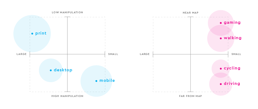
Map Size and Interactivity Levels 
Integrating ArcGIS Pro & Web Mapping in the Cartography Curriculum
Monica Lloyd of Centre of Geographic Sciences (COGS, NS, Canada) offers a story map on the topic.

Thursday, June 22, 2017

GIS Education Weekly: High Schoolers Map the Impact of Katrina on Crime and Collect Images on the Summer Solstice

A part of the overall winner's
story map
Articles and Resources

University of Minnesota: U-Spatial Prize Highlights Thought-Provoking Data Maps - University of Minnesota's U-Spatial, which supports spatial research as part of the Office of the Vice President for Research’s Research Computing unit, selected nine submissions out of 50 as winners of its 2017 Mapping Prize.

Inside Sources: Geography Increasingly a Priority for Schools, Employers - The article covers the American Geographical Society's vision for education and its support for APHG and AP GIS&T. There is commentary on open source vs. proprietary software: "In general, the availability of free or open source data platforms has not always been good news for the incumbents in other industries. Education publishing companies for example have been reeling in recent years from the competition of freely available or cheap web-based lesson plans. [Chris] Tucker [chairman of the board of AGS], however, does not believe that the same dynamic is at work in the geography space, saying that he thinks the public and private sides of the market are 'feeding off one another' as the sector continues to grow."


Thursday, October 6, 2016

GIS Education Weekly: Self-driving Car Engineer Nanodegree, Teaching Historic Offensive and Minecraft

Programs, Degrees and Courses

From the Self-Driving Car Engineer Nanodegree Video
Udacity has opened registration for 250 seats in its Self-Driving Car Engineer Nanodegree program. Sebastian Thrun, the founder of Google’s Self-Driving Car program and co-founder of Udacity, is an instructor. Partners Mercedes-Benz, Didi, Otto and Nvidia will look at students for potential employment. The program spans nine months and runs $2400 (scholarships are available). Via @geoawesomeness.

Thursday, June 9, 2016

GIS Education Weekly: UCLA Extension's One Year Certificate, U-Spatial Grows, Nat Geo Fellow Inspires Lab Schoolers

Programs, Degrees and Courses

UCLA


UCLA Extension offers a one year GIS certificate (22 Mb PDF brochure). The estimated cost: $8,475.00. I asked some questions of Nick Burkhart, the Academic Coordinator, Geospatial @ UCLA.

1. "Coursework is grounded in the structure of the U.S. Department of Labor’s Geospatial Technology Competency model, which is required for most GIS and geospatial technology industry employees." How is the program related to the GTCM?
...our program was designed with the GTCM in mind, and ... we are continually making a concerted effort to ensure that our courses train students in the core geospatial abilities and knowledge specified in the GTCM and other relevant standards documents.  
He shared a table showing which of the courses are most closely related to core competencies outlined in the GIS Body of Knowledge.

2. Does the program uses both proprietary and open source software?
...we emphasize training in ArcGIS given that it is the industry standard commercial desktop GIS platform, though we do (particularly beginning in our Intermediate GIS course) introduce QGIS and encourage students to develop experience with ArcGIS as well as free and open source alternatives like QGIS.
3. What makes the UCLA Extension GIS certificate program different from other online programs? What is unique?
Several key characteristics distinguish UCLA Extension's online GIS certificate program from other online programs: (1) our program is primarily designed to serve students with little to no prior GIS experience, and (2) our instructional design deviates from the standard step-by-step ArcGIS tutorial-based training model that is so common in university-level GIS education.  The weekly practical exercises in all five of our courses provide students with scaffolded learning experiences wherein students are given the responsibility of thinking critically about process and outcomes.  This form of instructional design encourages development of true mastery of GIS techniques as students are thinking less about which buttons need to be pushed and more about the broader sequence of steps necessary to meet a given objective.  While we are relatively young as a professional certificate program, our certificate program courses are built upon the established GIS curriculum that we use here in the Department of Geography at UCLA.

Thursday, May 28, 2015

GIS Education Weekly: AP GIS&T Course, First Community College UAS Exemption, Official QGIS Curriculum

Esri Updates ConnectED Page 
Map from a lesson on Magellan
from Thinking Spatial with GIS

Esri updated the original ConnectED page to one that's clearer and includes more resources. I confess I was nervous about sharing the original version; it was very confusing. Now the main page focuses on two things:

1) free teaching resources including GeoInquiries (new), updated Mapping our World for ArcGIS Online (original content 2002) and updated Thinking Spatially with GIS for ArcGIS Online (original content 2008)

2) getting a free license via a pop-up form

The single introductory video ends with the Esri logo and "Applied Geography."


Sinclair Community College Receives UAS Exemption
The Sinclair National UAS Training and Certification Center has been granted a Section 333 Exemption by the Federal Aviation Administration (FAA), paving the way for broad educational and commercial unmanned aerial systems (UAS) operations.
The Ohio institution is the first community college in the United States to receive an exemption and expects to pursue others.


College GIS Projects Redefine Poverty

Like many other GIS professors, University of Washington Geography professor Sarah Elwood has her students do real world projects.
...but this quarter is the first time nearly all of the 10 class projects have an inequality or social justice aspect to them. That focus is intentional: Elwood is the co-founder of the Relational Poverty Network, a UW-based international coalition she launched with fellow geography professor Victoria Lawson to reframe how poverty is perceived and researched...

Monday, April 13, 2015

New Options in Online Geospatial Learning: Discover Spatial

There are far more choices for those who want to learn about geospatial technology than ever before. One of the newer options is Discover Spatial, a brand of Australia’s GIS People. I asked Tom Egan, Co-Founder to explain how the platform works and what makes it different from other options.

Ignite Education (IE): What makes Discover Spatial’s offerings different from other online GIS classes, like those at Lynda.com (just acquired by LinkedIn) or those from vendors like Esri?
Tom Egan (TE): As you may already be aware, the geospatial industry has an estimated US$270 billion value worldwide and has been around for 40+ years. So it should come as no surprise that there is a lot of interest in learning about geospatial science and technology. That’s the good news. The bad news is that geospatial training and education is very fragmented at the moment and can be quite expensive. If students want to learn about GIS for example and keep their skills up to date, they will likely have to learn about Esri ArcGIS, Pitney Bowes MapInfo, Google Maps, Hexagon Geospatial, MS SQL Server, Oracle Spatial, FME, CartoDB, etc… So spare a thought for all these students that up until now have had to enrol into courses across many different vendor and eLearning websites.
Enter discoverspatial.com, the world's first and only geospatial eLearning marketplace where students can learn in-demand geospatial skills with easy to follow courses from a wide variety of trainers across the globe. Discover Spatial is a global platform giving students access to a wider range of expert trainers and courses then what they could ever possibly access through a single vendor site or even a university/college degree. Our site is vendor agnostic and designed to be a hub for all geospatial education, giving students all the geospatial learning options in one single, convenient platform. 
From what we’ve researched, existing eLearning portals such as Lynda or Udemy either have very broad focus or provide very limited offering for geospatial training. As such, they are not well placed to provide the best learning experience or compete with the breadth of training options we will ultimately offer. Discover Spatial on the other hand is purpose built to cater specifically for users interested in teaching or learning spatial. 

Thursday, April 9, 2015

GIS Education Weekly: Students Making Map, New MOOCs and non-MOOCs, Smart Mapping

Interviews

Wesleyan Students Make a Story Map of Campus

The team used ArcGIS and ArcGIS Online to make the map (current version) of the Wesleyan campus per an interview with DeNeile Cooper in the school paper. I found the reflection on the project prompted by the question "What did you learn in the process?"most interesting.
The Map Journal-based story map does not have a legend
just yet, but it is a works in progress.
I think we all learned a great deal about patience from the project. Many of the steps were so elaborate that we would spend a full hour working on something, step away from it, and not be able to readily tell what had been done. I personally gained a great deal of respect for the opportunities that ArcGIS opens up. There are so many stories, concepts and theories that can be more effectively communicated by using the tools that ArcGIS provides to create a map that is at once critically engaging and artistically appealing. Working on the project also deepened my appreciation for the work that Physical Plant staff members do each day. The database and map that we received from them was very thorough in its description for each building, and I think that’s indicative both of how much work the staff members put into making sure the university is run well, and how knowledgeable they are of the campus in a way that no student could conceive of. Paraphrasing artist Mierle Laderman Ukeles here, thank you, Physical Plant, for keeping Wesleyan alive.
I hope the students find a way to embed their names as map authors on the Map Journal-based story map. I am regularly frustrated by story maps where I cannot determine authorship!

Mapmaker Matchmaker: Suchi Gopa and the Power of Maps

This article from Boston University profiles GIS professor Sucharita Gopal. Sounds like an important voice in GIS education that I've yet to meet!


New Courses/Workshops

New QGIS 2.8 Course

A new course focuses on version of QGIS 2.8.1. Pay $49 (not sure if it's US or AU) and you have access indefinitely. Four other QGIS 2.8.1 courses are coming to the Discover Spatial platform over the next two months. Look for an interview with Discover Spatial's co-founder next week. Courses at the GeoAcademy are still $25 each. There are no current plans to re-run the QGIS MOOC.

Thursday, February 26, 2015

GIS Education Weekly: Esri Launches GeoInquiries, Role Playing as a Teaching Tool, QGIS Training Explodes

Esri GeoInquiries: 15 Minute Lessons

There's a new beta resource for educators on the Esri Education pages, GeoInquiries. Esri's Charlie Fitzpatrick noted them in this article published yesterday about Esri and ConnectED. Designed to be presented by the instructor in ArcGIS Online, the first set are on earth science.
GeoInquiries are designed to be fast and easy-to-use instructional resources that incorporate advanced web mapping technology. Each 15-minute activity in a collection is intended to be presented by the instructor from a single computer/projector classroom arrangement. No installation, fees, or logins are necessary to use these materials and software. 
Currently, Earth science GeoInquiries are in beta and available for field testing. More GeoInquiry collections will be released throughout 2015.
I looked at a few of the lessons. Each is delivered in a several page PDF including a link to an ArcGIS Online map. There are learning objectives, details of the lesson relates to science standards and pointers to Earth science textbook chapters. The documents, all with a creative commons license, have the Esri, Amazon and GIS Etc. logos on them.

Role Playing with Web Maps Teaches Geography

One of proposals role players evaluate in
Tambopata: Who Owns Paradise, an edtech tool
 developed at the University of Wisconsin.
A team at Wisconsin published the paper Who owns paradise? Using web mapping to enhance a geography course exercise about tropical forest conservation (fee versionfree uncorrected pre-print pdf). The edtech tool the paper describes is free to use! Here's the abstract of the paper:
Here we present Tambopata: Who Owns Paradise?, a map-centric, multimedia website created to enrich an educational role playing exercise about biodiversity, conservation, and development in the Amazon (www.geography.wisc.edu/tambopata). The exercise assigns students a character from the Tambopata region of the Peruvian Amazon, and asks them to evaluate four proposed zoning plans from their assigned perspective. Using principles of web cartography, we designed the four proposal maps to communicate complex information and allow for increased exploration. Compared to the previously used static maps, the website increases opportunities for student engagement with the material, incorporates multimedia, and clarifies spatial relationships and land use patterns. The website is available publicly and can be integrated freely into other university and high school courses.
I would have studied this for my edtech course if I'd known about it!

Shark Tank Teaches Fourth Graders Geography

I think this is a creative way to teach geography and provide an authentic experience. Here's what they did in Darien, Illinois:
Fourth graders at The Lane School and their geography-based business plans were thrown into the “Shark Tank” on Thursday as they attempted to impress local tycoons. 
Groups in three classes researched natural resources, local economies and popular attractions in each region of the United States. They applied the information to a business model such as a resort or restaurant, which they pitched to pretend investors.

Thursday, January 29, 2015

GIS Education Weekly: Landsat, JMU, QGIS Course


Landsat image Finder Libra
Tool to Find and Download Landsat Images

Libra, from DevelopmentSeed, "allows you to browse, sort, and download more than 275 Terabytes of open Landsat imagery as easily as booking an Uber." Note that there's no "help"but you can probably figure how how to use it. That's a slick UI!

JMU's Geospatial Semester Recognized by State Math and Science Coalition
A James Madison University outreach program that gives high school seniors an experience similar to what they will face in college or on a job has been recognized as a "2015 Program that Works" by The Virginia Mathematics and Science Coalition. 
JMU's Geospatial Semester was one of 10 programs recognized by the coalition at events this week in Richmond. The awards recognize exemplary science, technology, engineering and mathematics programs that make a positive impact on student or teacher learning. To be considered for the award, programs must be at least two years old, must include an evaluation component, and must demonstrate that they are sustainable and can be replicated by others.
USGIF Scholarships

Doctoral, graduate, undergraduate or graduating high school senior studying geospatial intelligence or related topics can apply for the USGIF Scholarship Program. Applications are due April 20.

Thursday, December 18, 2014

GIS Education Weekly: Geo Course Syllabi Database, QGIS MOOC, BOK News

Note from Adena

I'll be continuing my regular Thursday recap of GIS education news here on the Ignite Education Blog. Please share news and stories with me via e-mail.

BOK 2.0 Ready for Review

University Consortium for GIScience President Steven Prager announced availability of its GIS&T Body of Knowledge for review.
...we would like to invite the community to take some time to review, contemplate and comment on the future of GIScience education. The report, available on the UCGIS website, is a major milestone heading down the path toward the new BoK2.0. We have created a forum space for commentary and discussion in association with this product and the BoK2.0 more generally.

National database for GIST and GeoTech Syllabi

The GeoTech Center is trying to build a database of GIS and geospatial technology syllabi. You can add your information by filling out a form and sending on content (details here). The database will be publicly accessible; no license is noted. I'm hopeful this request will eventually be publicly available on the GeoTech Center website, perhaps under the "news" section.

In other GeoTech Center news, it's time for award nominations.
Please nominate your Awardee and help recognize them for their contribution to geospatial education! The Nomination Form with more information about the Awards is available http://www.geotechcenter.org/distinguished-geospatial-education-awards-for-2015.html.
Directions Magazine won one last year. The glass globe is on my mantle.

Tuesday, March 6, 2012

A Phd Candidate Argues Against ArcGIS

Konrad M. Lawson is a PhD candidate in East Asian History. I'd never had learned of him had he not written about open source QGIS at his blog at the Chronicle of Higher Education. (Thanks to Gary Price for pointing me to the piece.) Lawson's post is titled Introduction to QGIS thought in fact it's more of a statement of "what I as a humanities researcher want from GIS."

What does he want? Software that

1) is inexpensive and easy to learn and use - ArcGIS fails in his opinion on both counts
2) will make cool maps - analysis is nice but beyond his needs
3) will allow the maps to look the way he likes
4) will allow maps to be created for use in presentations and publications

He goes on to explain that learning QGIS was as painful as learning ArcGIS but the former is free and runs on many platforms. Further, he notes that he would not like to be tied to a school for access to Esri software in the future. Lawson concedes that Google Maps/Earth can do some his required tasks but include busy basemaps which limit the value of the final products.

He concludes:
With a little time investment, I believe that becoming comfortable in an open source GIS environment like QGIS can go a long way for those of us in the humanities. Increasingly, prepared layers of geographic information, or at least tables of easily geocoded data can be found downloaded from various locations online. Being able to take any of that data and project it on a map for use in a classroom setting or in our publications, even without employing more advanced analysis does not require more than a few hours of investment in a GIS education.
I think the article is an honest description of the type of mapmaking many people want to do. I agree that ArcGIS may not be the right tool for them.

The commenters are quick to note that ArcGIS is far more user-friendly now than in the past. They fail to mention the new $100 Home Use Version nor ArcGIS Online, both of which might be helpful to Lawson and those in his shoes.

This article paints a picture of the current state of GIS with but two players: Esri on one side and open source on the other. The former is seen as expensive and complicated, while the latter is seen as free and complicated.

I can't fault Lawson for this vision, for I believe this is what he sees. I can fault us, the geospatial community, for either not providing him the tools he needs and/or not communicating to him that those tools exist.