ABS Consulting Group, Inc.: Home | Blog | Resume | Speaking | Publications
Showing posts with label esri. Show all posts

Thursday, November 29, 2018

GIS Education Weekly: Future of Work Skills Include Active Learning but not Spatial Ability

Resources

Inverse: Twitter Usage Data Can Map How Screwed Up Your Sleep Is - Scientists (biologists not geographers) at the University of Chicago are using tweets to explore U.S. residents' sleep loss.

Esri: Policy Maps - This is a nice interface to data for the U.S. There's an intro video here.

Thursday, September 28, 2017

GIS Education Weekly: Online courses more time-consuming to prepare

Articles

ASU Now: Mapping the border a 'huge technological undertaking' for ASU professor, students - An interactive map of the border wall was part of the Gannet Company's coverage of the topic. A GIS specialist and three journalism students at Arizona State University made the map.

Times Higher Education: Online courses ‘more time-consuming’ to prepare for, study says - "Online courses are more time-consuming for academics to prepare for than traditional teaching, according to an Australian study."

Thursday, April 27, 2017

GIS Education Weekly: Five Geo Companies Support Education!

Articles and Resources

Locate Press has announced a book for students aged 10-15 featuring QGIS: Open the Door to GIS
by Toni Fisher. There's a student and teachers edition with learning materials that focus on a single story for each week of the semester. It'll be available in Q2 of this year.

Introduction to web programming for GIS applications is a $100 course on Udemy from Michael Miller. Check social media for possible discounts.

Geospatial Brainstorming Blog: Why QGIS should be part of everyone’s GIS toolbox - The same Michael Miller noted above offers the "why" of QGIS. Of note is this comment on the post on LinkedIn: "My agency is so far behind in technology, I don't even know what this is. No training and lack of support for GIIS [sic] is my situation."

Tuesday, February 28, 2017

Be Careful What You Wish For: MOOC Edition

The Past

Back in 2015 I wrote a post on this blog titled Location Advantage Dropout. In it, I detailed my experience in Esr's Massive Open Online Course (MOOC) focused on GIS use in business. Depending on your perspective, I was brutal or honest as I described what convinced me to drop out of the course. I also provided suggestions on how to make the course better.

The Present

Today I'm Esri's MOOC program manager. I'm charged, along with my team (second to none, by the way), to develop and offer the best possible MOOCs. I like to think my passion for MOOCs and my evaluation of the course helped get me this position. I think it's time to respond to the points I raised, now that I'm on the inside. I want to address each of the suggestions I made in turn.

Thursday, April 7, 2016

GIS Education Weekly: Geo for All Plans to Expand Reach, What Students in GIS are Doing

Geo for All to Work with other GIS Education Proponents

Geo for All Logo
A thread on the newly renamed Geo for All mailing list addresses concerns about the group's singular focus on open principles and software to the exclusion of proprietary ones. It's worth reading but the upshot is that there is indeed an opportunity for Geo for All to reach out to, communicate with and perhaps work with organizations such as Esri and AAG who are helping to grow GIS and geography education. As of today, Geo for All is looking for some leadership for this effort. The phrase “More People Making Maps That Matter,” was a suggested rallying cry.

Subscribe!

Get this GIS education update free, via e-mail, every Thursday! Or just bookmark the blog and visit once a week. Or, follow me (@adenas) on Twitter where I tweet mostly about GIS and education, but also about GIS in general.

Monday, February 8, 2016

Hanging with GIS Educators in Maine: Just Click all the Buttons

MEGUG's GIS / Educators Conference, held last Friday in Freeport, Maine was not large. I suspect even if it hadn't snowed Friday morning, there wouldn't have been too many other attendees. But, as I've learned, sometimes those tiny meeting are the best.

I spent the day in the education track, which had between 10 and fifteen people for most of its four presentations (pdf of agenda). I wanted to share some of the presenters' and attendees' key ideas, as well as some of the thoughts that popped into my mind during the sessions.

Organizing Processes for Educators and Students 

I now have a handout titled Many Ways to Bring Your Data into ArcGIS Online. (It and other docs are here.) It details 10 different ways to bring "internal" and "external" data into ArcGIS Online. This is how an educator thought to teach other educators about the various processes. I searched the Web a bit and could not find any other document arranged quite this way. Educators think about teaching/learning/organizing differently than others.

Reinventing the Wheel  

While we explored the different ways to bring in data, specifically downloading and publishing data from the Maine Office of GIS during the above workshop, one attendee spoke up. He asked in essence, why the state does not offer these data as feature services. He asked educators and GIS professionals to let the states (and I'll argue any other orgs) know the value of these services to educators and their students.

Professional vs. Educational Software

I was reminded as presenters and attendees got lost among menus and had error boxes pop up, that ArcGIS is not designed for education.It is designed for professionals/experts. This is a blessing and a curse for educators and students.

Monday, January 4, 2016

What happened in GIS while you were away...

Most of us have been on vacation since about December 23. Here's some of what happened while you were away. 

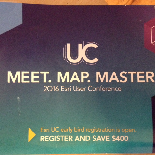
Esri is using a What3Words-like Format in its Esri UC Marketing

A physical mailer for the 2016 Esri Usr Conference appeared at the end of December with MEET.MAP.MASTER. on the front. I tried it in the What3Words tool and it's not a place. The mailer included a number-filled infographic with data to convince the recipient to attend the event. My favorite factoid:
76% of attendees gain an understanding of what others in there are doing.
Why the early mailing?
Apply your 2015 budget to the 2016 Esri UC 

Monday, December 14, 2015

2015: The State of GIS and Geography Education

An 1899 class in mathematical geography at
Hampton University, a historically black institution
Public Domain, via Wikipedia
I've been doing year end recaps of the GIS industry for more than a decade. My interest has focused more on GIS and geography education for the last few years. I started writing about the topic regularly when I was at Directions Magazine and continued via a newsletter which launched in December of last year.

This will be my first recap detailing the state of GIS and geography education.

Monday, December 7, 2015

Holiday Sales in the Geospatial Industry

Last week Amazon and other vendors loaded up my e-mail box and plastered my social media feeds with news of holiday offers. We are all familiar with the business to consumer marketing (B2C) that happens around the end of year holidays. At the same time, I found geospatial vendors sharing holiday offers to other businesses (B2B) and to individual professionals (B2P?).

Here are some of the offers I saw:

Thursday, October 22, 2015

GIS Education Weekly: GAO Report on Geography, Giant Maps for School Children

GAO: Eighth Graders Do Not Know Geography


Geography Proficiency Levels
of U.S. Eighth Graders, 2014, from
the report
Here's something readers probably know: Three-quarters of eighth grade students in the U.S. weren’t proficient in geography last year. That's the conclusion of a last week's Government Accountability Office report requested by congress. Via: Politico

Responses to the Report

Says Michael Gould (@0mgould) on article about the report:
article misses the point on US kids' lack of geographic knowledge: the system fails them. thx @josephkerski http://ow.ly/TCixA
The AAG published an article (press release?) highlighting the executive director and others quotable responses and the importance of the report.

Giant Map to Help Memorizing Idaho's Counties

Kershaw Intermediate School students in Sugar City, Idaho painted a map of the state's counties on the school blacktop. They used a number of math and graphic skills. And, of course they'll learn some geography. Per the article in the local paper:
Via Rexburg Standard Journal
The map of Idaho will allow the students to better memorize Idaho’s counties.
Is that true? Is there any research on the value of these giant maps be they "visiting maps" or more permanent painted ones? I recall when the giant U.S. map came to my elementary school gym (c. 1973). The best part? Sliding around on it in our stocking feet.

I also found "map painting stories" from Iowa and Ohio this week.

Subscribe!

A loyal reader commented a few weeks back: "This is simply the best source for geospatial education news on the planet. " Don't miss an issue, subscribe via e-mail.

Thursday, October 8, 2015

GIS Education Weekly: Investment in Location-based Learning, AAG GIS&T Course, Student Awards

Investment in Location-based Learning

A press release from Ambient Insights, "an integrity-based market research firm that uses predictive analytics to identify revenue opportunities for global learning technology suppliers," suggests mapping is hot this year:
Another interesting trend is the investor interest in digital cartography and mapping companies. These companies develop what Ambient Insight defines as Digital Reference-ware and Location-based Learning. Maps are inherently related to procedural learning in the same way recipes, product manuals, flowcharts, periodic tables, architectural diagrams, star charts, and schematics are related to learning. In the first three quarters of 2015, $72.0 million was invested in ten cartographic and mapping companies. This is significant considering that there were no companies of this type funded in 2014. 
"Some of the most extraordinary mapping innovations are now emerging around so-called indoor mapping and Indoor Positioning Systems (IPS) that work inside locations where GPS does not function," comments Adkins. Six of the ten mapping companies funded in the first three quarters are selling new IPS products. "Museums, galleries, and tourist venues are now avid adopters of IPS systems. For example, the American Museum of Natural History in New York City and the Royal BC Museum in Victoria have both installed IPS for their patrons."
A white paper on International Learning Technology Patterns (pdf) identifies some of the companies: Mapbox, CartoDB, Mapsense (recently acquired by Apple) and IndoorAtlas. Of these I know CartoDB is actually marketing in education, Mapbox started to do so, but then went rather dark. IndoorAtlas (with a US$10M infusion from Baidu) offers indoor tools for museums and exhibits but best I can tell malls and airports are more interested thus far than museums.

Geo-Literacy Projects Build Students' Understanding of Our Complex World

The article appeared in September on Edutopia. It's by the same woman who wrote a post titled Students Map Real-World Issues with (Free) Geospatial Tools on Edutopia last summer. There's nothing too earthshattering or different in this post: discussion of Geospatial Semester, Big Fork High School in Montana and links to Story Maps, NatGeo tools (via Gooru, of which I'd not heard), EAST and GeoMentors.

Monday, October 5, 2015

GIS Education Briefs: #GISed, Water on Mars Story Map, Geography Textbook Spat

#GISED

Esri's Joseph Kerski (@josephkerski)  made a suggestion this week regarding the hashtag #GISED and the Esri twitter account @gised.
Keep in touch with all that is happening in GIS education via #gised @gised
I find the hashtag and account quite valuable. The most active users of the hashtag are Esri folks (Kerski, @trbaker, and @GISEd), AAG GeoMentors (‏@AAGGeoMentors) and me (@adenas). I use the tag to highlight content of interest to those involved in GIS education, using any technology. I'd love to see more GIS education tweets tagged!

Questions About the Mars Story Map

You know what didn't get the #GISED hashtag on Twitter this past week? The Discovering Liquid Water on Mars story map. It got a lot of praise including these terms I found in tweets: "fantastic, " "awesome," "stunning," and "amazing."

The story map prompted lots of questions for me. What questions? I wrote them down as I worked through the story map. Each number below is a "dot" in the story map table of contents.

1) I really liked the opening time series from Horowitz Crater that shows the changes in the streaks made by water over time. I guessed that the MY had something to do with the Martian Year and looked up the details. The data shown in the time series are from 2006 through 2011. 

Location of Horowitz Crater
I clicked where indicated to "see Horowitz Crater on a satellite map of Mars." Since I have no specialized knowledge of Mars' geography the locator map didn't mean much to me. I wanted to see where the crater was on the globe of Mars. For example, was it northern or southern hemisphere? 

2) Next was a video of similar streaks on Hale Crater. I wanted a link to the source video so I could get more information about the time frame covered. I think I found the video source here. I also wanted to know where Hale Crater was relative to Horowitz. I tried a few online Mars maps including NASA's Mars Trek and Google's Mars Map but didn't find an answer.

3) The  next image showed Garni Crater with multiple streaks "many of them several hundred yards long." I found it cool to know how long they were! I wanted a scale so I could perhaps see how long they were in relation to other features. I found more information on the image in a NASA image of the day post. 

4) Palikir Crater, like Horowitz, includes a time series. Did Esri create the two time series? I can't tell from the credits/sources. 

The story map collects a lot of interesting images and animations and raises many geographic questions that require additional research to answer. That makes it a great starting point to learn about spatial thinking. The story map reinforces the value of time series imagery to show change over time.

What questions did the story map prompt you to ask? Did you follow up to try to find answers? Did you/would you use the story map in a geography or science class? How?

Slavery and "Workers" in Geography Textbook

World Geography is a textbook from McGraw-Hill Education. It includes a section called “Patterns of Immigration.” A caption of a map reads:
The Atlantic slave trade between the 1500s and the 1800s brought millions of workers from Africa to the southern United States to work on agricultural plantations.
A ninth grade student found the wording and his mother took the issue to Youtube. McGraw-Hill agreed something was amiss on its Facebook page . The company plans to remedy the situation by immediately updating the online version of the book and including the change in the book's next printing. The Chronicle of Higher Ed offers other choice quotes from the text. Update: Reuters  reports the company will send stickers to cover the errant caption. (Read more: CNN, Buzzfeed)

Thursday, October 1, 2015

GIS Education Weekly: NSF, OSGeo and MacArthur Awards and How to Win a Map Contest

Freshman Year for Free

If you missed it, a number of colleges and universities are aligned with Modern States Educational Alliance. The Alliance  which will organize more than 30 EDx developed freshman level courses and materials prepping students to take AP or CLEP tests. The idea is that using the free materials students can in fact gain credit via the (fee-based) tests at these institutions. AP Human Geography is not yet listed.

Face to Face  and Online Events (Two Online Ones Today!)

Safe Software Grant Program Webinar
Every year, over 4000 FME licences are donated to individuals and organizations who need it for research, education, [emphasis mine] conservation, and humanitarian efforts. Learn how 5 of our grant program recipients used FME to unlock their data and transform our world. 
The webinar is today at 8 am Pacific Time.

Sleepwalking into the Future? A World without Spatial Thinking

Esri's Joseph Kerski speaks on the subject (pdf flyer) today at the University of Redlands at 11:30 am PT or later (no actual time for talk is provided) via livestream (link to be here at time of event). A recording is expected to be available for later viewing.

AAG to Tackle Disruption in Higher Education

Thriving in a Time of Disruption in Higher Education will be a theme at AAG 2016 Annual Meeting set for San Francisco, California March 29 – April 2, 2016. Papers and sessions are welcome.

Clarion University GIS Conference

Clarion University will host the 10th anniversary Northwest Pennsylvania Geographic Information Systems conference Oct. 15 and 16. University community is free and everyone else pays a minimal fee for one or two days. Keynote topics: (1) Esri and (2) Ushahidi. Sounds like a great, small event.

Free ConnectED Webinar from Esri and NCGE

Wed, Oct 7, 2015 8:00 PM - 9:00 PM EDT, free
This webinar is designed for those just wondering how to start, with a special ConnectED offer from Esri for US K12 schools. Register now!: https://attendee.gotowebinar.com/register/2311089148719287297
GIS in Education & Research Conference, Toronto, Nov 30

The University of Toronto and Esri Canada are hosting the one day event with keynoter Mike Goodchild as the keynote speaker. The event is free.

Subscribe!

Afraid you'll miss this important news? Subscribe to receive it via e-mail each Thursday.

Monday, September 28, 2015

Strategies for Linking to a Story Map or ArcGIS Online Map

Sharing that Great Map

Lots of time and energy have gone into producing your latest online map. Now it's done and it's time to tell the world about it in a press release, article or via social media. What URL do you use and how do you include it in the text? Here are  few strategies that work well.

City of Vista Interactive Planning Projects Map - A Story Map

Most of the stops on the City of Vista Story Map Tour of projects.
Different colored pin distinguish those pending review, approved,
under construction and completed.


The San Diego Tribune last week highlighted a new interactive map from Vista, CA showing proposed projects in that city. Here's why the map was created.
The new web page, posted last week, follows a year of uproar after uproar from different neighborhoods throughout Vista, which after years of stagnation in new-home construction is in the midst of a building boom primarily focused on apartments and other multifamily projects. ...
Homeowners who live near many of the proposed projects have flooded City Hall with concerns over traffic, parking, property values and more — and many have complained that they didn’t know about a project until it was near the end of the approval process.

Thursday, September 24, 2015

GIS Education Weekly: GISCI Exam, Skills Competition Finalists, MOOC Update

GISCI Announces Exam Application Period!

The exclamation point in the press release (and above) illustrates how excited the organization is about the news, which appeared last Friday. Bottom line:
  • Exam application period runs Monday, September 21 and closes October 9, 2015.
  • Apply here.
  • Exam Dates: Nov 12-17, 2015 at PSI Testing Centers.  I've never heard of this provider, but found nine in Massachusetts (on a Google Map!).
  • Deal: Early qualified applicants can get $100 Application Fee and the $100 Portfolio Review Fee reimbursed.
Modeling Human Trafficking in St. Louis
As part of her master’s thesis at the University of Missouri—Columbia, Amanda Colegrove, director of the Crime Victim Advocacy Center’s Coalition Against Trafficking and Exploitation (CATE), thought about taking what researchers consider as risk factors for human trafficking and applying them to the landscape of St. Louis.
The idea, backed by the Washington University School of Medicine and Brown School of Social Work is to integrate data on topics that tend to encourage traffic to determine "hot zones," then see if in fact the predictions are accurate based on documented prosecutions. The study also looks at resources to prevent and respond to trafficking. Among the ideas floated are "UburHouse," a way to have those in community shelter victims until they can find permanent safe housing.

Geo For All Student Awards

Geo for All announced the winners of the OSGeo Student Awards for FOSS4G 2015, Seoul. Going forward, the Student Award initiative at FOSS4G conferences will be handled by the Geo for All team. There are no details on what the students won or how many students participated. I'd like to see both details included in future news releases.

Tuesday, September 15, 2015

Fox Buys 73% of National Geographic: End of the World?

21 Century Fox did What?

Exactly what did Rupert Murdoch's 21st Century Fox do? NPR reports:
In a $725 million deal, the 127-year-old National Geographic magazine is leaving behind its nonprofit status and becoming a key piece of a new venture between its parent organization and 21st Century Fox.
Fox is Already in National Geographic

If you've not kept up on cable TV deals, 21st Century Fox already owns about that much of National Geographic TV. That deal went down 18 years ago. The channel currently reaches 500 million homes worldwide.

Thursday, September 10, 2015

GIS Education Weekly: NCGE Challenge Winners, Service Learning, Drones

What the Planet Really Looks Like

The Daily Mail wrote quite a bit about The True Size, a Web app that compares the size of countries and highlight the challenges of the Mercator projection.

Case Study: Is [GIS] Service Learning Worth the Effort?

Short answer: Yes.  Georgiana Bostean from Chapman University explains how she does it and why it's worth it.

Bay Area Geo-Educators Summit
BayGeo is convening a Bay Area Geo-Educators Summit on Friday, October 2 at Stanford University. We hope to see many fellow educators from K-12, colleges, and universities from the Bay Area. 
The primary objective of the Summit is to give educators teaching and using geospatial technology a semi-structured yet informal forum to meet and share ideas.

Thursday, July 30, 2015

GIS Education Weekly: MapLift, GeoAcademy, Programming Languages

MapLift: Enhance your Resume and Do Good
This summer, we want your help in building maps for Wikipedia! Join mapmakers from around the planet for the first ever MapLift, organized by NACIS and the FixWikiMaps Project. From August 28th through September 4th, our collection of volunteers will be contributing their skills to upgrade existing Wikipedia maps and make new ones. It’s a great way to celebrate International Map Year!
This sounds like a great project for individuals, classes and others to use to enhance skills and help make Wikipedia maps better. Details of who, what, when etc. are on the NACIS project page.

Subscribe!

If you'd like to receive the GIS education news weekly via e-mail, sign up here! And, please share the link with others involved in GIS teaching and learning! To my knowledge this is the only resource of its kind.

Top Programming Languages

The IEEE Spectrum offers a list of the current top programing languages based on data from GitHub, CareerBuilder and eight other sources. Among the top ten are C (1st), Python (4th) and R (6th). There's also a Web app (99 cents) that will change the weightings and offer filters for specific uses/industries.

Thursday, July 2, 2015

GIS Education Weekly: ConnectED at 2, R Course, When Maps Lie

ConnectED at Year Two

The White House put out a fact sheet about its ConnectED Initiative now that it's two years old. Esri has been in the program for one year at this point (press release from 2014).

Here's how Esri was listed among the private sector contributors:
Esri: Providing $[sic] free access to ArcGIS Online Organization accounts – the same Geographic Information Systems mapping technology used by government and business – to every K-12 school in America to allow students to map and analyze data.
I'm not sure why a dollar amount was not included; it was for other companies.

Esri put out a map: the national map of ConnectED commitments from a handful of companies:


U of A Putting GIS in the Library

Staff members of the University of Arkansas at Little Rock’s Collections and Archives division plan to create a service to improve students’ research capabilities. The division was awarded a $4,000 grant to develop GIS support for student research at Ottenheimer Library.
The grant is seed money for the library to install a GIS workstation, train librarians and staff on GIS theory and methodology, and support the development of an interdisciplinary GIS project in collaboration with faculty.

Subscribe!

If you'd rather get these weekly posts via e-mail, sign up here!

Tuesday, May 19, 2015

Location Advantage Dropout

The second week of Esri's Location Advantage MOOC begins today. This was to be the first "geoMOOC" I attempted. I steered clear of all the others since I felt too much like an "insider" since I'm in the industry and I'm an educator. I decided to try the Location Advantage specifically because it focused on the use of GIS in business, something I've not studied nor covered much in my career.

I got through the introductory lecture materials. Some lectures included PowerPoint slides, some were interviews and and one was just audio. Yesterday I watched the “assignment” video about our first project exploring bank branches in Toronto and gave up. I’ve happily completed three other MOOCs, all from universities. Two were Coursera partners and the other an EdX partner.

I know Esri is not a university and has different goals for its MOOCs. I looked forward to my lectures and assignments in my other courses, but somehow this MOOC did not draw me in. I spent some time thinking about why I gave up on the Location Advantage and came up with a few ideas.