Ashcloud Apocalypse Global Risk Results Map
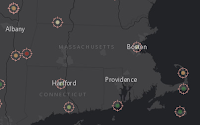 |
| Not too much data in Massachusetts. |
Esri UK and others put together a GIS Day activity based on a volcano eruption. The
sign up page explains it's "A hazard risk mapping activity for Geographers." Here's the
AGOL map used to drive the activity. The final map created by participants is the
Ashcloud Apocalypse Risk Map.
A tweet from Michael Gould (
@0mgould) reports:
>9000 entries and 6 million map views in 1 week!
Indiana State and PrecisionHawk Partner on Growing UAS Industry and Education
Indiana State University and Raleigh, N.C.-based PrecisionHawk have signed a research and development partnership that aims to advance the unmanned aerial systems industry from multidisciplinary perspectives. The university-business collaboration will focus on safety, education, training and algorithm development for PrecisionHawk's DataMapper aerial data software.
These Students Don't Need Any Help Finding a GIS Project
I see too many students (college and grad) asking for help finding a topic for their GIS projects. Two students at
University of Pittsburgh at Bradford didn't have any trouble. They fish and hunt, so they gathered data about ice fishing holes and deer sightings. Now the hope is the data and maps are good enough to let one of the student's grandfathers bag a deer when he visits!


