ABS Consulting Group, Inc.: Home | Blog | Resume | Speaking | Publications
Showing posts with label oer. Show all posts

Thursday, October 8, 2020

GIS Ed Weekly: Should SLU faculty train spies and warfighters?

COVID-19 Mapping 

College Crisis: Davidson College started  The College Crisis Initiative (C2i) "to learn how colleges and universities innovate in a crisis mindset." First up is a dashboard covering college education delivery plans during the pandemic. I first heard about the initiative via NPR, which has its own set of visualizations on college COVID-19 testing.

LinkedIn: Tanya Berger-Wolf, the director of the Translational Data Analytics Institute at OSU notes on LinkedIn that the Ohio State University was the only institution to receive an “A+” for its COVID19 dashboard according to We Rate Covid Dashboards, a website that rates college and university COVID dashboards. The team includes a number of students and faculty from Yale and other schools though it's unclear to me if they created the rubric or assigned the scores. I'm curious who is behind the site. If I had to guess I'd say tableau.

Thursday, March 5, 2020

GIS Education Weekly: Faculty from Two Georgia Schools to Write OER GIS Text

Coronavirus Mapping

NPR (Shots Blog): Map: US States With Coronavirus Infections - How helpful is this map in the context of Ken Field's discussion from last week?

The Conversation: Coronavirus outbreak: a new mapping tool that lets you scroll through timeline - I only this week found this article and map from Edward Parker, Research Fellow in Systems Biology, London School of Hygiene & Tropical Medicine. Via Google Maps Mania.

Thursday, January 23, 2020

GIS Education Weekly: Place, Race and STEM Education


Resources for Teaching and Learning

Twitter: Jen Mapes, who teaches at Kent State, shared a visualization of the abstract submissions to the AAG conference (to date). She's kindly shared it and many academics are noting its value.

Business Insider: These are the states with the most bars 100 years after the US went dry and banned alcohol - Technically, the headline is incorrect. Discussion or quiz question: What should the headline be?

Thursday, September 12, 2019

GIS Education Weekly: Award-Winning Geography Open Educational Resources

Resources for Teaching and Learning
 
Bloomberg: Here’s Who Owns the Most Land in America - "The 100 largest private landowners in the U.S. own 40 million acres—an area the size of Florida." Via Pitney Bowes staffers on LinkedIn. This is an interesting interactive map with a very detailed explanation of how the data was gathered and verified. The project includes data from Pitney Bowes and the use of QGIS. 

Thursday, August 1, 2019

GIS Education Weekly: Using Teachable to Teach GIS

Resources

Governing: Where Nonprofits Are Most Prevalent in America - "But not all cities benefit from nonprofits in the same way. Some places have a far more robust nonprofit sector than others." Let's go to the map on the right!

99% Invisible: Invisible Women - One of my favorite podcasts explores how design ignores women.The first illustration relates to the differences in travel patterns of men and women and how that led to changes in how a city in Sweden plows its streets. I kid you not! Listen to or read this immediately.

Thursday, February 28, 2019

GIS Education Weekly: SocialCops Course Covers Mapping Geospatial Data in R

On and Off Campus

The Edge: Business Briefs - Williams College has a new interactive map showing the college’s sustainability initiatives. A Williams senior and the college sustainability coordinator built it during fall 2018 on platform called Concept 3D. Middlebury has one, too, built on the same platform.

University of Wisconsin: Online MS in Cartography and Geographic Information Systems helps GIS professional map his future - A working professional is taking an online program for a Masters. His employer is paying of some of it and he's looking for a scholarship to pay for the rest.

Thursday, April 19, 2018

GIS Education Weekly: Mapping Evictions and Student Debt

Eviction Rate
Resources

The Eviction Lab: Matthew Desmond's latest project, The Eviction Lab, collects and maps data about evictions in 48 states and DC. Via Fresh Air.

Mapping Student Debt - Interactive map from the Washington Center for Equitable Growth with data made possible by Generation Progress and the Higher Ed, Not Debt partners. It's a Mapbox map with data from 2015.

Thursday, December 21, 2017

GIS Education Weekly: Plagiarism, Poetry and Posters

Resources
Alabama Maps: Old and New

Quartz: Two maps explain the racial history behind Alabama’s senate vote - "This 1860 map from the US Census (pdf)–a beautiful relic of a horrible part of US history–shows the distribution of slavery in the South. It was made to raise money for sick and wounded soldiers of the army. And while correlation is not causation, there is a startling visual parallel when you zoom in to Alabama on the map and compare it to how Alabama just voted this week."

Earth Imaging Basics - A video series from DigitalGlobe narrated by Josh Winer.

Thursday, June 23, 2016

GIS Education Weekly: My New Job, CCSU Certificate, Students Map Beer Caves

News from Adena

I've accepted a position on Esri's education team. I'll start in July focusing on MOOCs and universities. Unfortunately, I will miss the Esri Education GIS and User Conference this year.

Courses, Programs and Degrees

Central Connecticut State University

Thad J. Dymkowski, GISP, an instructor at Central Connecticut State University, answered a few questions about that school's GIS certificate program, which I mentioned last week.

1. I do not see any mention of programming, though I do see the creation of Web apps in the third course. Is there a programming component?
Students are introduced to OOP [object oriented programming] as a general topic first, discussing the general theory behind OOP. There are topic specific lectures and lessons on programming in Python as well as JavaScript/HTML. The Python lecture is an in-depth introduction of the basic building blocks, scripting syntax, and the use of it within the ArcMap environment as well as the ModelBuilder environment. The other programming lecture in the third class discusses API's in the context of JavaScript, HTML/CSS, Silverlight (though less so now due to its devaluation), as well as programming for Apple IOS and Android. Students are introduced to the syntax as well as the coding environments.
2. What software is used beyond Esri’s? I only see Esri.
GIS software (general) is covered in course 1 highlighting all the major companies and organizations on the market, in addition to open source software throughout the program. Course 2 covers open source GIS in further depth and specifics with nods given to QGIS, uDig, and a few others. Because of its prevalence in the industry, Esri is the foundational software used in the course.

Thursday, December 3, 2015

GIS Education Weekly: Boundless Details Program, Ashcloud Apocalypse Results, ISIS Geography Assignment

Ashcloud Apocalypse Global Risk Results Map

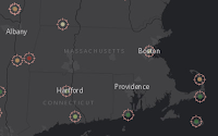
Not too much data in Massachusetts.
Esri UK and others put together a GIS Day activity based on a volcano eruption. The sign up page explains it's "A hazard risk mapping activity for Geographers." Here's the AGOL map used to drive the activity. The final map created by participants is the Ashcloud Apocalypse Risk Map.

A tweet from Michael Gould (@0mgould) reports:
 >9000 entries and 6 million map views in 1 week!
Indiana State and PrecisionHawk Partner on Growing UAS Industry and Education
Indiana State University and Raleigh, N.C.-based PrecisionHawk have signed a research and development partnership that aims to advance the unmanned aerial systems industry from multidisciplinary perspectives. The university-business collaboration will focus on safety, education, training and algorithm development for PrecisionHawk's DataMapper aerial data software.
These Students Don't Need Any Help Finding a GIS Project

I see too many students (college and grad) asking for help finding a topic for their GIS projects. Two students at University of Pittsburgh at Bradford didn't have any trouble. They fish and hunt, so they gathered data about ice fishing holes and deer sightings. Now the hope is the data and maps are good enough to let one of the student's grandfathers bag a deer when he visits! 

Thursday, April 30, 2015

GIS Education Weekly: GeoMentor Program Launches, Open Educational Resources

Esri and AAG Launch GeoMentor Program at AAG Conference

Esri and  the Association of American Geographers formally launched their GeoMentor program at last week's annual meeting. The current goal is support for the growth of Esri's ConnectED promise of ArcGIS Online for K-12 and informal schooling in the U.S. I first wrote about the Esri/AAG collaboration back in February.

I saw very little on Twitter about the program, but did learn that organizers promise GeoInquiries 
"won't take any more time for teachers." I wrote about GeoInquiries in February, too.

I dug into the GeoMentors website. I could not identify any new content, but can confirm that existing Esri materials are well organized. The site identifies two different support communities for GeoMentors: AAG GeoMentors Knowledge Community (a Google Group) and an Esri GeoNet Group. When I signed into the AAG group, there were two members, neither of whom is me.

This statement on the GeoMentors site makes clear who is ultimately responsible for the Esri ConnectED program's success:
With the goal of ArcGIS Online usage in 25,000 US K-12 schools by 2017, the success of this program ultimately depends on people like you, volunteering your expertise as a GeoMentor and proactively seeking opportunities to bring GIS into new schools across the country.
While AAG promotes acting as a Geomentor as "giving back," there are no details on exactly what participants might gain. Does participating earn GISP points (this PR suggests yes)? Can participation be considered professional development for educators? Is serving as a GeoMentor good for one's career? Do participants get a badge they can put on LinkedIn? A page with answers to questions like these could be valuable marketing collateral.


Subscribe

Don't miss an issue of GIS Education Weekly! Sign up for the weekly e-mail. Here's what you've missed.

Tuesday, December 17, 2013

A Geographer Looks at EdTech in 2013 - Part 8 - The Battle for Open

--- This post is the eighth in a ten part series examining top 2013 trends in education technology in the context of GIS and geography education. ---

Watters notes that "open" continues to be a trending and yet confused term within education technology. While lots of announcements included references to projects, code, courses or data described as "open," many were not open in any meaningful way. Others were merely "open washed."

In geography and GIS education I think we did a bit better in using "open" to reflect at least one of its true meanings in recent years.

In 2012 Esri announced its ArcLessons would be released under a Creative Commons License.

In 2013 Esri decided to remove the fee on its SpatiaLabs lessons and made it available with an Esri educational site license. (Not open, exactly, but with no fee.)

Back in September 2011, the Open Source Geospatial Foundation (OSGeo) and the International Cartographic Association (ICA) joined forces to "establish Open Source Geospatial Laboratories and Research Centres across the world for supporting development of open-source geospatial software technologies, training and expertise." To date there are 63 set with a goal of 100 research labs worldwide by Sep 2014. (See Geo for All)

In 2013, there were four "open to all" massive open online courses on GIS topics. Two focused on Esri technology, one on free technology and one on Google technology. (I recapped MOOC ideas and these courses in this video. References are on All Points Blog.)

In 2013 TeachGIS.org launched to try to get educators to share ideas. Sadly, it began to lie fallow as its creator took a new job.

All of these are great, forward-thinking efforts. I'm hopeful those involved will document and share the impact these have on geography and GIS education. But, I have a sneaking suspicion that I've raised in the past: "open" sounds good and providers and educators may both "vote" yes on it, but that does not mean it will be used. That lack of use by the target audience may lead unexpected consequences.

Consider all the discussion of how MOOCs will democratize education for all. In reality, some 80% of those taking the courses already have bachelor's degrees. As idealistic and important and morally correct as open is, it's but one tool in our educational arsenal.

Monday, August 27, 2012

Does Esri Going OER with its Ed Materials Matter?

I was pleased to see Esri make a formal statement about its commitment to open licensing of educational (not training) materials developed by its Ed Team. The company is retaining copyright, but offering ways to use and recast the content via a Creative Commons license. (If that doesn’t make sense, I recommend this short video that helps explain how copyright and Creative Commons licensing work together.) The move didn’t surprise me since it’s something Esri Director of Education David DiBiase championed during his tenure at Penn State.

The announcement got me thinking about how and frankly if OER geography resources are being used and/or re-used. I can’t say for sure that any material from my two OER courses at Penn State has been explicitly used, but I’ve seen evidence that suggests it has.

DiBiase and his Penn State colleagues put together what I consider a quite comprehensive text book for the first course in Penn State’s GIS Certificate program. It’s called the Nature of Geographic Information and it’s been available under an open license for years. I went looking on the Web to see if any educators use it in their online or residence teaching. I found references from the University of Massachusetts and Princeton. I can’t say outside of the Penn State community I’ve ever spoken to an educator who used it. I know only a subset of educators seek existing OER resources or consider building their own. I still see online conversations among educators trying to identify the best textbook for GIS from the commercial publishers. I'm not sure I've seen a discussion that included OER materials.

What are the implications of Penn State and Esri’s efforts to open up their educational resources? The question is timely in part because Audrey Watters, the education writer, is just beginning a project to explore OER content. Her first post on topic appeared last week on her Hack Education blog. (She’s prolific and I confess that I keep up by listening to her weekly podcast.)

Watters shared her takeaways, after looking at the types of OER content available at OER Commons:
It isn't just that the topics skew STEM. It's the dearth of primary-level materials. It's the amount of test-prep (often AP-test-prep) content. It's the preponderance of PDFs. And even with somewhat clearer language regarding licensing ("no strings attached" and "read the fine print" as opposed to Creative Commons' terminology), the continuing confusion surrounding copyright affordances for classroom usage.
First I want to tackle the dearth of primary-leve materials. Esri’s Educational Advisory Board identified the opposite in its review of the companies ArcLessons. (Disclosure: I’m on that Board.) The consensus was more intermediate and advanced material was needed. I for one see intro GIS material popping up all over the place. The latest source to cross my desk: Step-by-Step from the Scholars Lab. (I do want to point out that these lessons are peer reviewed, something that is not true of all open lessons. They are also available under and open license.) Does the geospatial/GIS education community really need more tutorials about how to geocode spreadsheets? I’m not sure. If we do, is it because there are not enough OER materials? Or did the Scholars Lab lesson appear because educators wanted a peer reviewed resource? Or for some other reason?

Next, I want to consider the PDF issue Watters notes. Esri offers quite a lot of material in PDF, though that did not come up in the advisory board discussions, best I can recall. I do see complaints from those trying to use raw data presented in PDF to make maps and we in the media (I work for an online geospatial publication) complain about press releases delivered in this form. For those who don’t use PDF much or don’t think about its limitations: the format was designed to make documents look pretty across platforms, not make their contents usable. Use of PDF in my mind pretty much flies in the face of the OER re-use/re-mix vision.

Now back to my initial question: What are the implications of Penn State and Esri’s efforts to open up their educational resources for geography/GIS education? My gut says it’s a good idea and probably “the right thing to do.” Further, I expect virtually all educators would vote in favor of such licensing. I'm not sure how many would open up their own work to such licensing. But those observations beg the question: Do geography/GIS educators know about or currently use OER materials that are already available?

I return to the question because of a well-told story of a focus group some years ago discussing MP3 players. When asked if they’d prefer a pink one or a black one, nearly all the panelists said “pink.” At the door, on the way out after the session, was a table full of pink and black devices. Attendees were invited to take one home as part of their compensation. They all took black ones. (Note: My pink 2nd gen iPod shuffle is giving me the eye just now...)

I plan to return to this topic of OER geospatial/GIS materials in the coming days and weeks.