
Another interesting trend is the investor interest in digital cartography and mapping companies. These companies develop what Ambient Insight defines as Digital Reference-ware and Location-based Learning. Maps are inherently related to procedural learning in the same way recipes, product manuals, flowcharts, periodic tables, architectural diagrams, star charts, and schematics are related to learning. In the first three quarters of 2015, $72.0 million was invested in ten cartographic and mapping companies. This is significant considering that there were no companies of this type funded in 2014.
"Some of the most extraordinary mapping innovations are now emerging around so-called indoor mapping and Indoor Positioning Systems (IPS) that work inside locations where GPS does not function," comments Adkins. Six of the ten mapping companies funded in the first three quarters are selling new IPS products. "Museums, galleries, and tourist venues are now avid adopters of IPS systems. For example, the American Museum of Natural History in New York City and the Royal BC Museum in Victoria have both installed IPS for their patrons."A white paper on International Learning Technology Patterns (pdf) identifies some of the companies: Mapbox, CartoDB, Mapsense (recently acquired by Apple) and IndoorAtlas. Of these I know CartoDB is actually marketing in education, Mapbox started to do so, but then went rather dark. IndoorAtlas (with a US$10M infusion from Baidu) offers indoor tools for museums and exhibits but best I can tell malls and airports are more interested thus far than museums.
Geo-Literacy Projects Build Students' Understanding of Our Complex World
The article appeared in September on Edutopia. It's by the same woman who wrote a post titled Students Map Real-World Issues with (Free) Geospatial Tools on Edutopia last summer. There's nothing too earthshattering or different in this post: discussion of Geospatial Semester, Big Fork High School in Montana and links to Story Maps, NatGeo tools (via Gooru, of which I'd not heard), EAST and GeoMentors.
Frugeo Student Paper Award

Frugeo is giving a publication opportunity to students and the chance to win an award. Details are here; papers due January 15, 2016.
Use Student Google Apps Log-ins for CartoDB
Whether you’re new to CartoDB or a seasoned senior, all students can now link their Google Apps-based university email accounts directly into CartoDB! In a few clicks this union lets students skip the sign up process and get right to mapping while also receiving a pretty sizable bump up in data storage space and student resources. Talk about elevating education!Details are in this blog post. Anything that can lower the number of student log-ins for cloud solutions makes educators, GIS-focused and otherwise, happy!
Subscribe!
Afraid you'll miss this important news? Subscribe to receive it via e-mail each Thursday.
AAG Announces Writing and Advisory Committees for Proposed AP GIS&T Course and Exam
The writing committee will lead the development of the proposal, which will consist of a course description, a recommended assessment, a plan for teacher professional development, outreach strategies and an initial list of participating universities and high schools. The AP GIS&T writing committee’s methodology has already been vetted by an external advisory board. All the names of folks involved are in this news release. There will be upcoming requests for other stakeholders to participate in this project.
Ohio State Students Map Vacant Lots
Mattijs van Maasakkers and and Jacob Boswell, both assistant professors at Ohio State University, kicked off a mapping project as part of the Ohio Land Exchange Project, which hopes to connect organizations wishing to improve the community with vacant lots of land throughout the Lima area. Nine undergraduate students worked with faculty members and graduate students Saturday as they identified several tax-delinquent vacant lots and mapped them.Funding is from an Engagement Impact Grant from OSU’s Office of Outreach and Engagement. The students are using iPads to collect the data. GIS and graphing are only mentioned in an invisible caption:
Lance Mihm | The Lima News OSU-Lima students Kenna Rice, Dave Braun, Beverly Steele and Hali Finfrock identify a vacant lot and graph it on a GIS mapping system. The research is part of a project aimed at improving the use of vacant lots in Lima.
 Latest Geo for All Newsletter
The PDF is downloadable here. I appreciate that the editorial focuses on a few corrections from previous newsletters. Far to few publications offer any follow up or corrections on previous articles.
Apply Geotech to your Archeology Research
The Spatial Archaeometry Research Collaborations (SPARC) Program, a National Science Foundation-funded initiative at the Center for Advanced Spatial Technologies at the University of Arkansas, is accepting applications for archaeological research projects in the spring and summer of 2016.Applications due Nov 6. Via: UArk News
Araoz Outstanding Student
 |
| Alexis Araoz, with ILGISA President Andrew Vitale |
Western Illinois University junior Alexis Araoz was presented the Outstanding Student Award during an Illinois Geographic Information Systems Association (ILGISA) conference.
Araoz, a geography major from Rockford, IL, was nominated for the award by WIU GIS Center Director Chad Sperry.She wants to work at NGA and it sounds to me like she has the right stuff.
Treating River Blindness Only Works if you Know where the Potential Patients Are!
For her work using high-resolution satellite imaging to locate village sites, [Sarah] Amirazodi, a [University of Alabama in Huntsville]The challenge came from the Carter Center and ended up in with a team including the intern in the NASA Marshall Space Flight Center's DEVELOP office at the University of Alabama in Huntsville. The challenge: find semi-nomadic villagers living in a deep and massive South American rain forest who are not yet treated for river blindness.
junior majoring in Earth system science (ESS), was awarded one of three $1,000 scholarships presented to DEVELOP students by Science Systems and Applications Inc.
This week scientists were awarded a Nobel prize in medicine for solutions to roundworm parasites that cause such diseases. Such solutions only help if you know where the people who need it are located!
PSU News
How MOOC Teaching Impacts Residence Teaching
A few Penn State professors address how they are taking what they've learning teaching MOOCs back into the classroom. Among them is Map MOOC instructor Anthony Robinson.
Online Global Parks and Sustainability Course Uses Student Made Interactive Videos
A general education course at Penn State has been revamped to include interactive videos designed to teach students about conservation and sustainability. The course, Global Parks and Sustainability (GEOG 001), will be taught online in spring 2016 by Erica Smithwick, associate professor of geography in Penn State’s College of Earth and Mineral Sciences.Smithwick got a grant from the Center for Online Innovation in Learning (COIL) to have students in last year's "Parks and People" course to create videos while studying abroad in South Africa. The video are enhanced with "annotated commentary from instructors at specific timeframes, pop-up questions, and 'branching,' in which new storylines can be followed." I'm biased (as a PSU grad, former faculty member, and current advisory board member) but I love Penn State's commitment to teaching and learning; this is awesome.
Esri News
New GeoInquiries
There are new GeoInquriries for Human Geography and U.S. History. I'd love to see Esri include the date of publication on the index pages so we'd know which ones were newly published or updated. Have any readers tried out GeoInquiries? Did you decide to use them in class? How?
Apply for Teachers Teaching Teachers GIS (T3G) 2016
Esri’s 8th educator institute will bring 100 educators to Redlands Sunday July 17 – Fri July 22, 2016. Applications are due by Nov 9, 2015. Participants pay for travel and some food. There are some pre-requsites and some required post event homework. Via: Esri blog post.
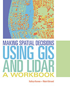 New LiDAR Workbook
Making Spatial Decisions Using GIS and Lidar: A Workbook is the third book in the Making Spatial Decisions series. Per Joseph Kerski on Esri's HigherEd-L, it focuses on "scenario-based problem solving using an integrated workflow in ArcGIS for Desktop. These are ready-to-go activities coupled a rich set of data that represents much of 'what's new and forward-thinking' in GIS and remote sensing data and curricular resources." Cost: $US80.
Wizard to Pick the Best Story Map Template
A new Create Story wizard lets users pick one of the hosted Story Map apps and start building. Perhaps more valuable for teaching and leaning is the Ask the Pros button, which prompts for answers to some simple questions, and suggests which app to use. Via: ArcGIS Blog post
Visualize Your Water Challenge for High Schoolers in Great Lakes/Chesapeake
Environmental Protection Agency (EPA) and USGS, with the assistance of ED, are working with the private sector to address nutrient pollution. Nutrient pollution is one of the nation’s most difficult environmental challenges. While nutrients are essential compounds for functioning ecosystems and the production of food, fiber, and livestock feed, excessive nutrient levels can dramatically alter aquatic environments and threaten economic and human health. Today, EPA, USGS, ED, the Great Lakes Observing System, and Esri are announcing the “Visualize Your Water” Challenge. This Challenge seeks to engage the innovative spirit of high school students in the Great Lakes and Chesapeake Bay watershed states to create compelling visualizations about nutrient pollution using geographic information system (GIS) software in conjunction with water quality data collected through Federal, state, and local efforts. The “Visualize Your Water” Challenge will help students cultivate career-oriented skills and learn about local nutrient pollution issues while encouraging environmental stewardship.It ties into Esri's ConnectED work. Via: Government Fact Sheet
Update 10/8:: Esri now has a landing page with details. Grand Prize:
An opportunity to attend the Esri Education Conference, publication of winning map in Esri Mapping the Nation book, promotion on USGS, EPA, and Esri websitesRecent post(s) from Ignite Education