I sat down to write my annual list of "10 events, ideas, themes, products, etc. that stood out over the preceding 12 months" but found it more difficult than usual. There were some things I "could" talk about (John King and the Magic Wall, the iPhone, geotagging as mainstream, warehouse appliances and XML databases), but they really weren't standouts. There were some "continuations" of existing trends (open source, cloud computing, Web 2.x/3.x) but again, nothing that shook the foundations of our industry. In the end, I deemed the list "lame." My editor-in-chief, Joe Francica, agreed with my description and noted a few things that I might have added (spatial regression, SQL Server 2008 with geo support, GeoEye-1), but even those felt like "more of the same." Don't get me wrong, I see progress, but nothing like the things I'd identified and felt strongly about in past years.
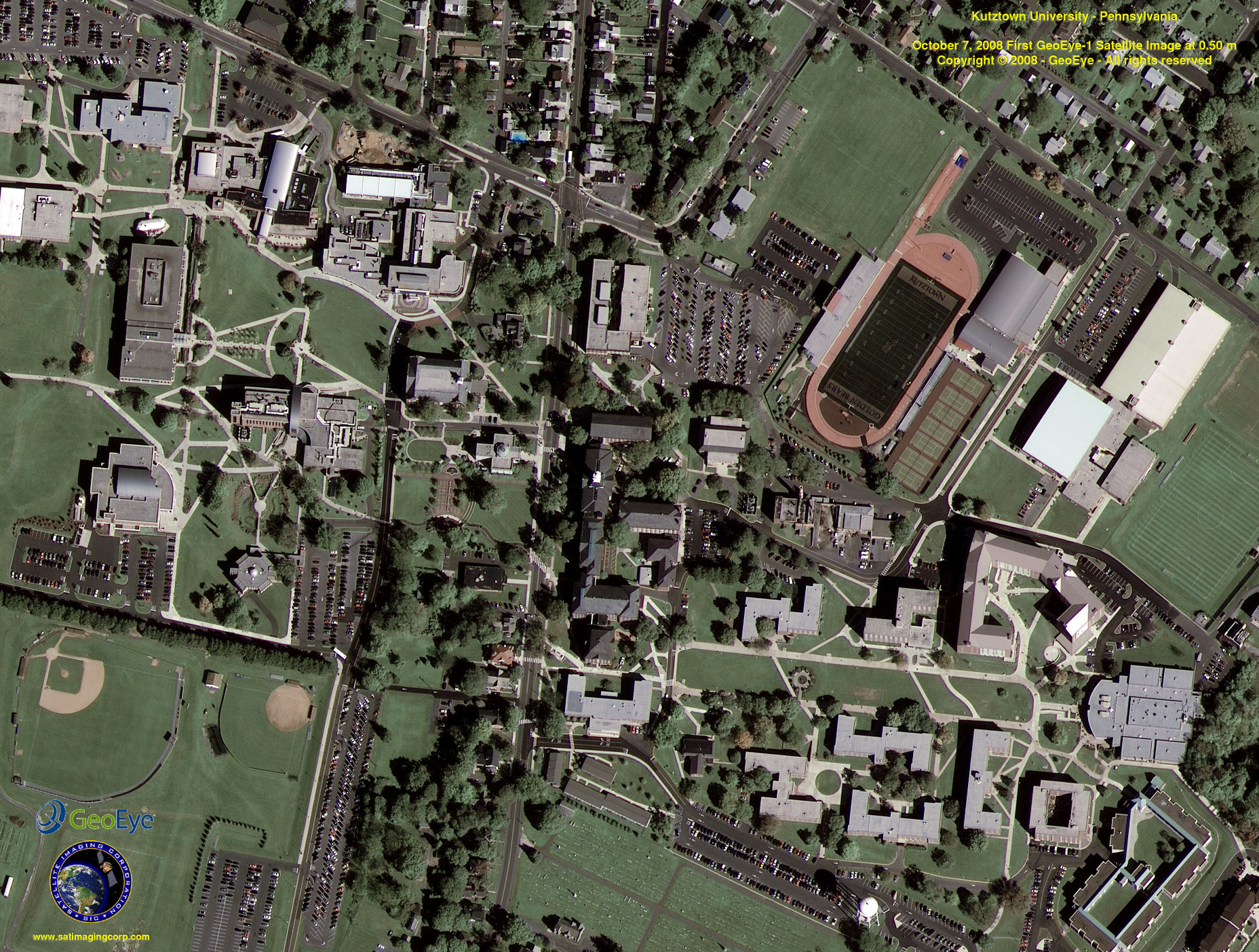
GeoEye-1 imagery, like this "first image" of Kutztown University, will provide .5 meter resolution to the world via Google's mapping properties. (Image courtesy GeoEye)
So, what's going on? Is it me? Am I, and I hate to ask this question because it makes me feel old, getting jaded? Have I reached a "there's nothing new under the sun" view of geospatial technology? I don't think so. Some things excited me quite a bit this year, including ESRI's vision of data finding via Google tools and the introduction of FortiusOne's Maker!. I'm guilty of not following up much on these. Still, they are both having an impact of sorts. Regarding data "findability," I was jazzed to see GeoServer's new tools for making geodata findable via a Google search, which launched this past week. As for Maker!, I'm happy to report that the reporter from the Boston Globe who called about a "Year in Maps" article, found the Dataset of the Day series on the Off the Map Blog terrific.
Am I looking in the right places? Certainly my "sources" for news about geospatial have exploded in the past year or so with more e-mails, press releases, blogs, tweets, podcasts, videos and, thankfully, fewer phone calls. Is it possible that the variety of communications channels has spread the "news" so thin that none of it achieves "critical mass" such that it makes an impression on me? I would not discount that explanation, but it's certainly not the whole story.
One of my sources, the GeoSpatial News Aggregator.
Or is it, as Joe Francica noted in a recent editorial, that we've crossed a chasm and are now in a mode of "diversity, segmentation and focus"? And if so, what do those three terms mean for finding "10 events, ideas, themes, products, etc. that have stood out over the preceding 12 months" that speak to our entire community? In pondering this situation further, I think the diversity of uses and users, from those who mash-up to those creating new spatial algorithms for vector and raster data, reinforces that we are less likely now, perhaps than ever, to point to the same "big events, launches, trends." The segmentation Francica points to does the same thing. The implementation of an enterprise GIS may well include a geospatial appliance, but only the system administrator may know about it. The analyst at her desk may be querying data faster but analyzing data in ArcGIS as she always did. Thus, the selection and implementation of a solution from a Netezza or Teradata may not be on her radar. Similarly, those geospatial practitioners who manage the datastore in those databases may not really notice that data being fed in aren't from a commercial vendor, but from OpenStreetMap. To him, there's no difference; it's just "data." Francica's ideas regarding focus are applicable here, too. At one time it seemed ESRI, Autodesk, Intergraph and MapInfo (and others) were in the same business, GIS. Today, they most assuredly are not. They deal in (these are my terms, not the vendors) broad geospatial technology, infrastructure, security/military/intelligence and business-focused location intelligence, respectively.
OpenStreetMap data rocks some GIS users' worlds, but not others'.
What does all this say about the state of geospatial technology? I think Francica has it exactly right - it's mature. I know that I miss that users can't all sit in a room together and get "wowed" by the same new technology, as perhaps we did even five, let alone 10 or 15 years ago. On the other hand, we can still appreciate that advances in other corners, while not directly touching us now, may in time, or via new connections between our data, applications and hardware.
Each runner has different preferences, but all share a love of running. (Photo (c) Larry Sandhaas, used with permission.) (I'm the "cutoff" person on the left; Howl at the Moon, Danville, IL)
The analogy I'm holding in my head as I write this involves my running club. We are some 400 strong. Some like to race short distances (less than a mile), others longer (six to ten miles), others even longer (26 to 50 to 100 miles). Some don't race at all. Some like to run in the woods; some wouldn't ever try that. Some like to run alone, others in large unwieldy packs. What holds us together? We all like to run. Within geospatial, we may be pulled to a particular disciplinary use of the technology (forestry, health care, agriculture), or part of the technology stack (database, middleware, application), or hardware solution (desktop, field unit, mobile phone), but we are all pulled to this technology by love or money. So, perhaps it doesn't matter that we don't now, and may not for some time, identify the same year-end inventory list of great steps forward.


