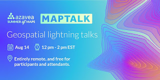
Azavea: MapTalk - "MapTalk is a mini-conference composed of lightning talks on geospatial analysis projects undertaken as a summer fellowship, internship, or research project. It will take place at 12p - 2pm EST on August 14, 2020, and be entirely remote, and free for participants and attendants." Organizers are looking for presenters who are "students, interns, and those just starting their careers." Apply to participate by Aug 6.
University of Lynchburg: Free COVID-19 Mapping Workshop offered at Lynchburg July 23 - a free, online workshop at the University of Lynchburg from 7 to 8 p.m. on Thursday, July 23: “Mapping a Pandemic: Using Geospatial Technologies to Track and Understand the Spread of COVID-19.”
UCGIS: Conversations about Resiliency in GIScience Education - The organization is hosting three discussions on different themes, in three different time/geography zones, starting later in July.
- Theme 1 - Pedagogies for resilient GIScience education
- Theme 2 - How does our technology improve or hamper our ability to be resilient?
- Theme 3 - Implementing resilient GIScience education
Chronicle of Higher Education: How to Make the Most of a Virtual Conference - This is a good list for educators and students.
Resources for Teaching and Learning
Twitter: A tweet raised questions about a changing legend in a series of COVID-19 maps. Then folks started discussing it on Twitter. Then Jonathan Schwabish, of the Urban Institute posted Critiquing a Data Visualization Critique on his Policy Viz site.
The New York Times: Online Map Collection Provides a Peek at New York Over the Centuries - "The Brooklyn Historical Society’s collection of nearly 1,500 digitized maps dates back to the 17th century."
Cornell Chronicle: New book explores maps as tools of political power - Cornell sociologist and science studies scholar Christine Leuenberger has a new book, “The Politics of Maps: Cartographic Constructions of Israel/Palestine,” co-written with Izhak Schnell of Tel Aviv University.
Axios: Why the world map froze - "This is the longest period in modern history during which the world map has remained unchanged."
Twitter: Michele Tobias asks #gischat "What's the best assignment you ever got (or gave!) in a GIS or map-related class? Why did you like it? What did you learn?"
The Dispatch: Social Bonds are Fraying Fast in America's Cities - "The social fabric in our cities is not only rapidly breaking down, but the pandemic has also accelerated American’s interest in leaving cities for places where geography enables social bonds with others to be stronger."
Colorado State: Claim Building Dig: Archaeology students help solve a long - Students in the course Digital Digging explored the university's Claim Building which did not appear on any maps. "They analyzed existing data from LiDAR scans of the campus, and gathered original readings of the area through geophysical methods including magnetometry, electromagnetic induction, and ground-penetrating radar."
Esri
Esri: Welcome to the Esri Education Team's Higher Education UC 2020 Expo! - The Education Team put many of its favorite resources into an Experience. My team (Learn ArcGIS) is also exploring using Experiences. Is this better than a blog post or article? A StoryMap? A Hub?
ArcGIS Blog: Coaching the Next Generation of Spatial Data Scientists - Gregory Brunner, an adjunct professor at Saint Louis University (SLU), and Esri staffer uses ArcGIS Notebooks in his courses. He's the author of a new Learning Path at ArcGIS Learn.
ArcGIS Blog: Coaching the Next Generation of Spatial Data Scientists - Gregory Brunner, an adjunct professor at Saint Louis University (SLU), and Esri staffer uses ArcGIS Notebooks in his courses. He's the author of a new Learning Path at ArcGIS Learn.
